LOCATING HELSINKI | Helsinki, Finland | Unit 21 | 2015
A MASTERPLAN FOR THE HELSINKI METROPOLITAN AREA ASSEMBLY | Helsinki, Finland | Unit 21 | 2015
Awarded Distinction for Design & Distinction for Thesis
Awarded The Bartlett Medal


We are often drawn to maps as they offer a tangible scaled presentation of territory. The map stands as the middle ground between fictional ideas, visions, and the reality of territory.
The urban planning of our built environment has never adopted a tool with greater influence than that of the zenithal, iconographic, planometric map. The ability for the map to interpret and project fictional visions prior to physically altering reality has been one of its greatest assets. The map allows us to transcend between scales understanding the hidden social systems creating a useful tool in the laboratory of urban and master planning.
Click to zoom ->

Click to zoom ->

Click to zoom ->

The project is based in the capital city of Finland, Helsinki. It has been chosen for its unique political background. The identity of Finland has always been closely tied to the map and how its territory has been depicted. In its history it has been a territory of Sweden to the west, a branch of the Soviet Union to the east and an extension of the European Union to the south. Its boarders have shifted throughout its history, drawn and redrawn to suit the occupying country of that time. The scheme explores the physical, social and digital cartographic mapping techniques at the three epochs in the history of the capital. Each political system has fashioned a different urban form produced through cartographic methods.

Click to zoom ->
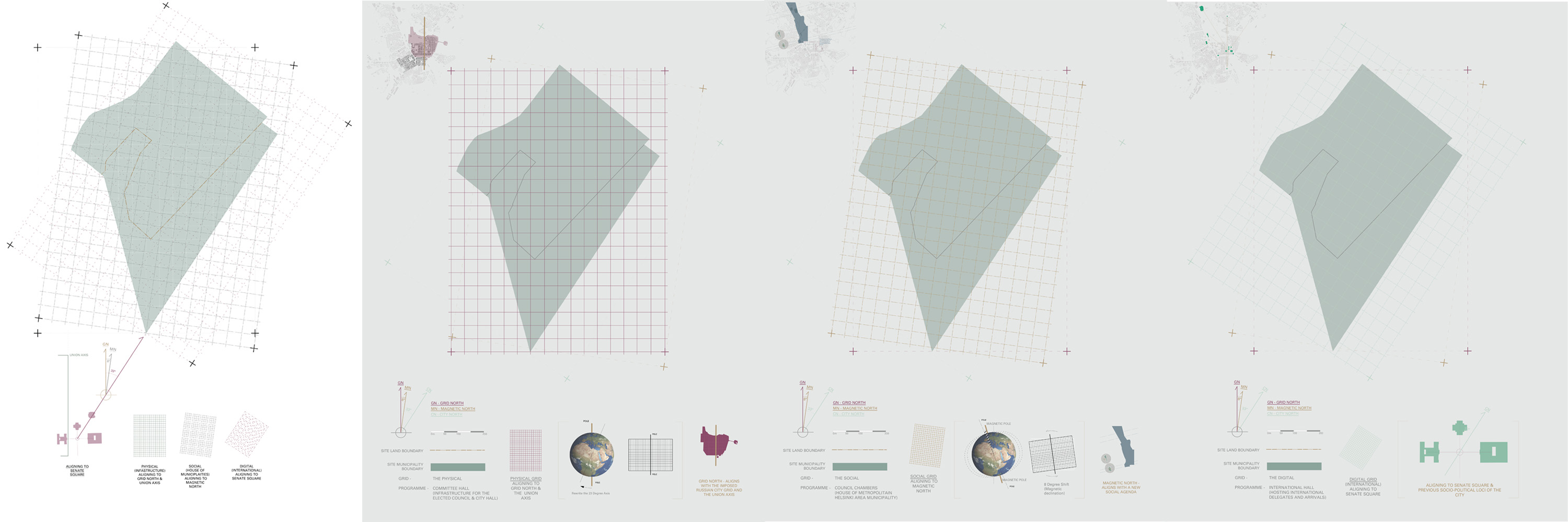
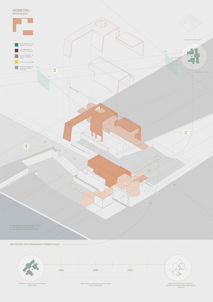
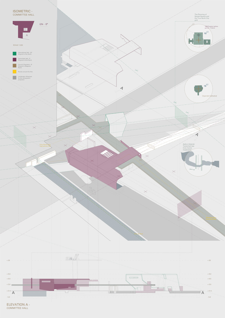
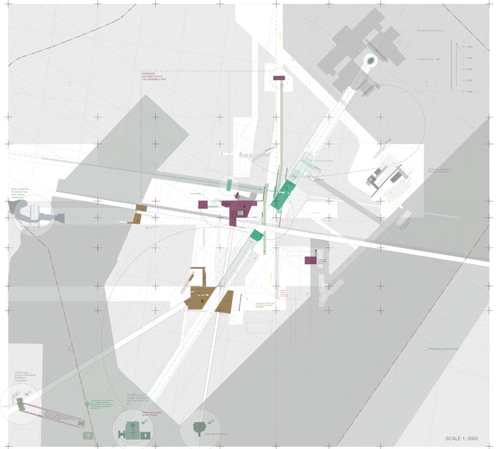
The programme is for a new masterplan for Metropolitan Area Assembly to unite the divided municipality system governed by the map. It is sited on the Hanasarri power plant site, close to the famous Senate Square. The coal powered power plant has a large physical presence and is to be decommissioned in 2025.
Click to zoom ->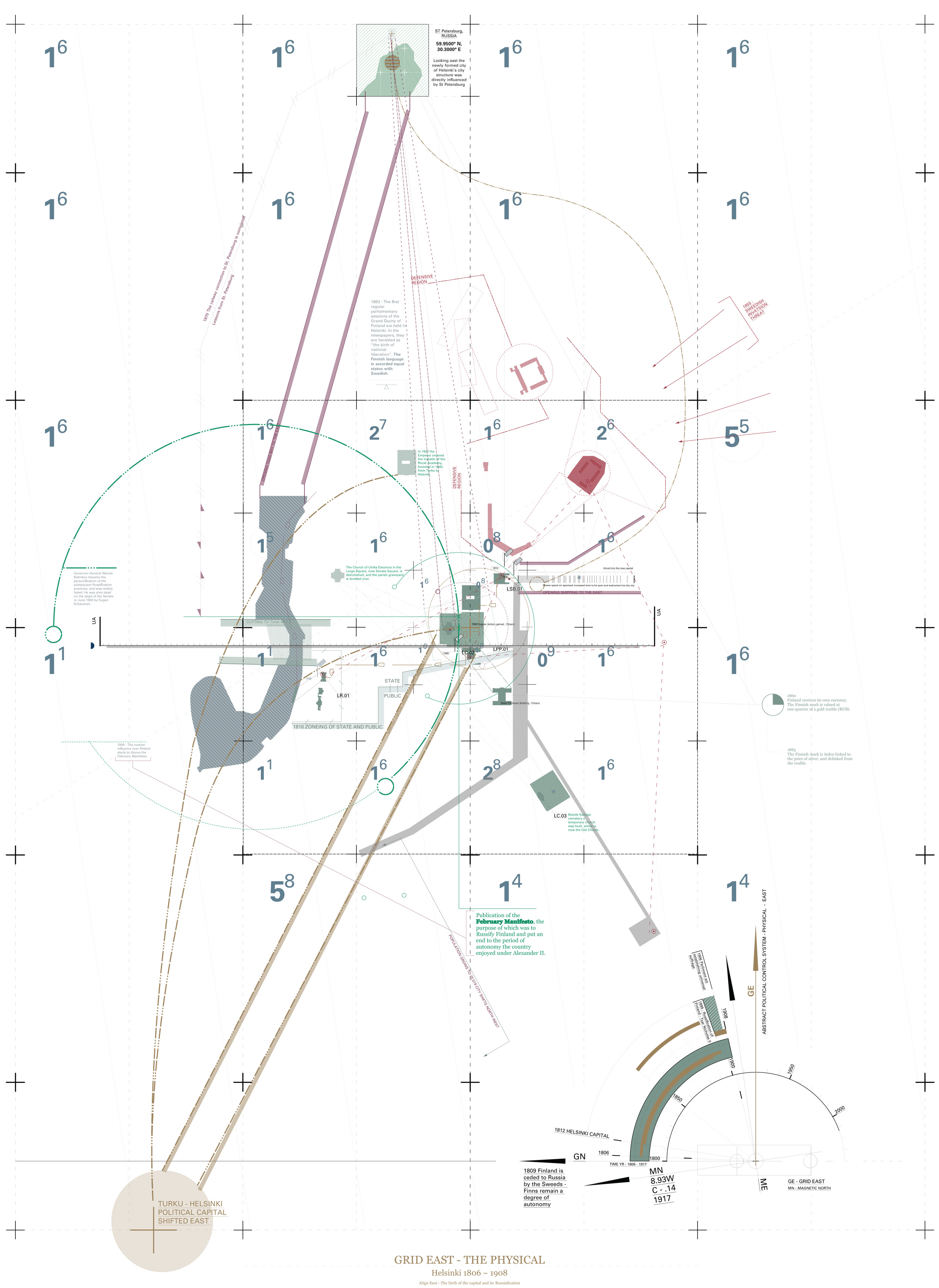

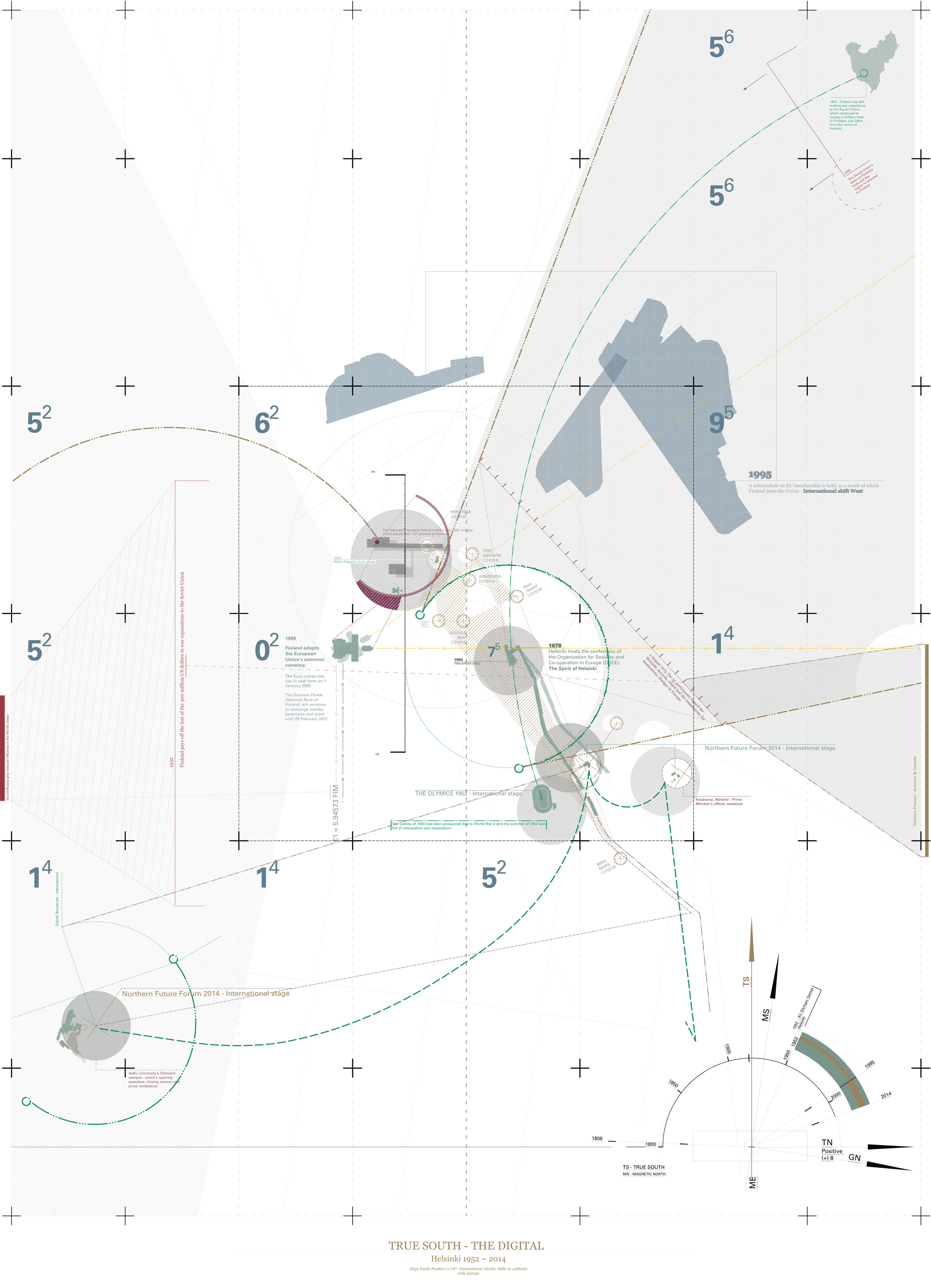
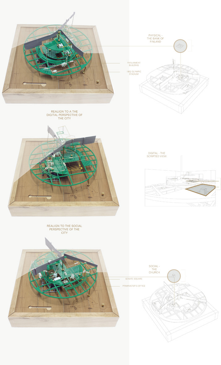
The Masterplan sets out three grid systems based on the political epochs of the past and forecast to the future; grid north (the physical), magnetic north (the social) and city north (the digital).

The key physical nodes of the assembly programme are set out on to the different grids that relate to the different cartographic orientation to the human scale, city scale and international scale.